
 Image 1 of 5
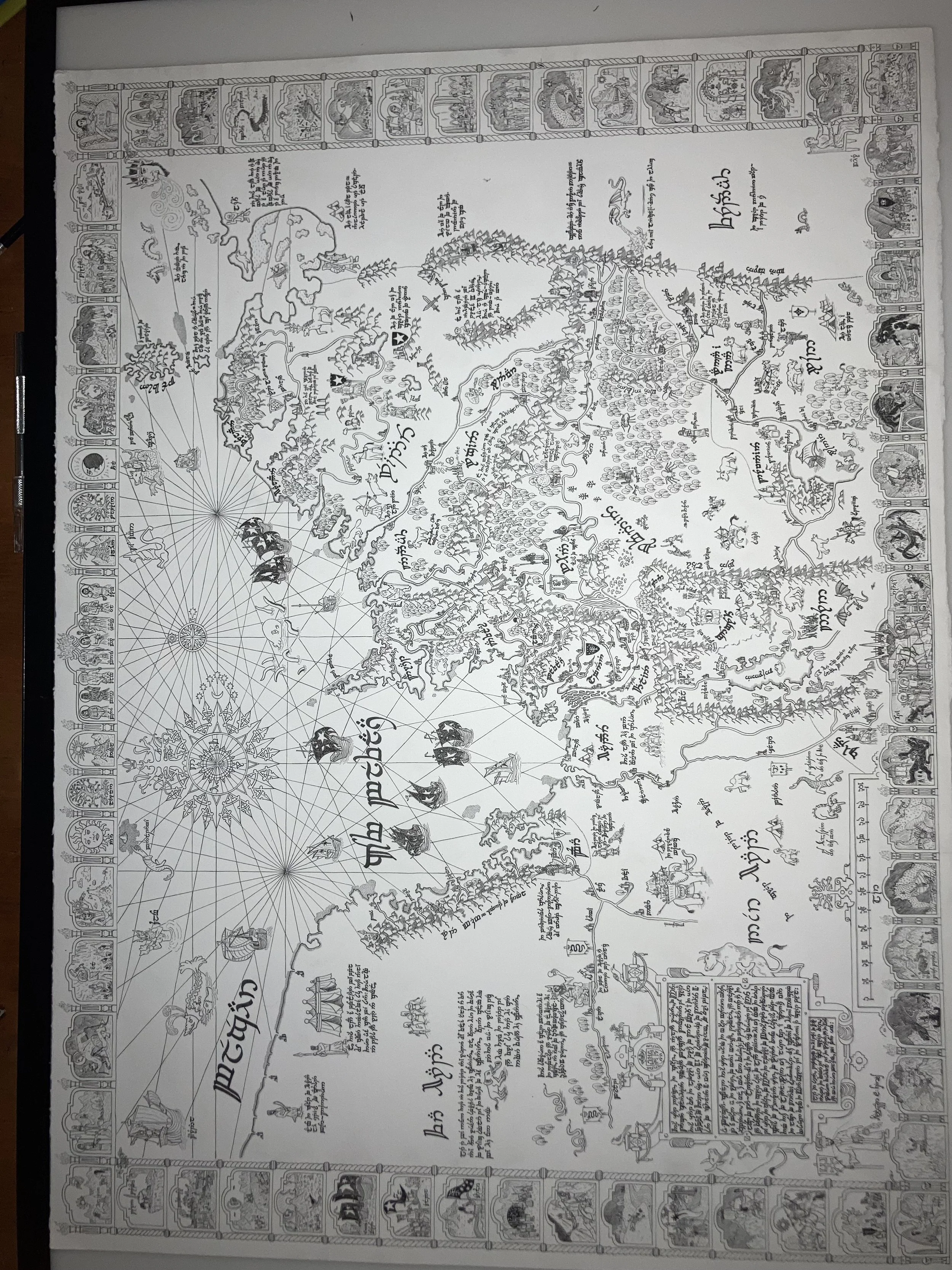 Image 2 of 5
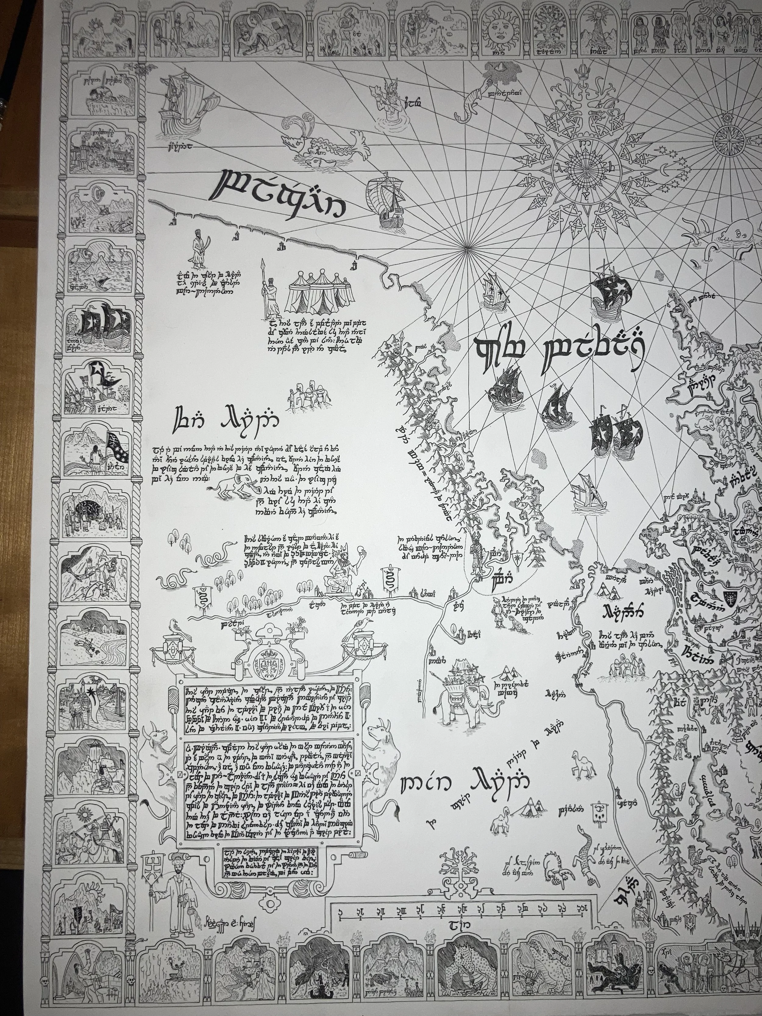 Image 3 of 5
 Image 4 of 5
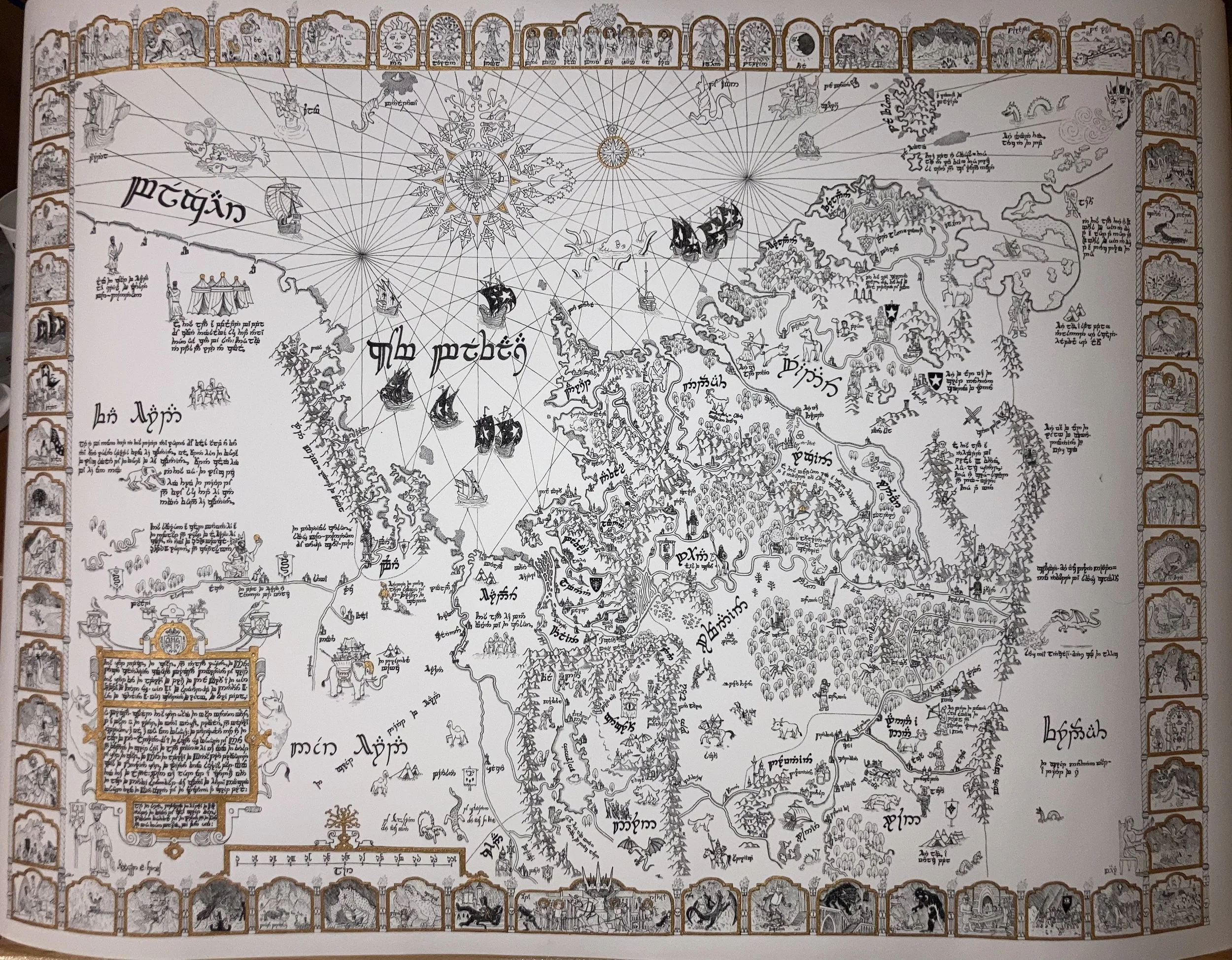 Image 5 of 5
I drew this map of Middle Earth from the perspective of a Gondorian cartographer working in the year 2997 of the Third Age. This map is oriented to the West, to the Valar and the Undying Lands - a sacred direction to the Gondorians - not unlike the medieval European tradition of orienting maps to the East, pointing towards Jerusalem as the center of the world.
The map is replete with references to Tolkien’s own illustrations, as well as those of Pauline Baynes and references to historical maps. I drew stylistic inspiration from medieval and early-modern European cartography - in particular the maps of Dutch cartographer Jan van Linschoten, the Swedish clergyman Olaus Magnus, and the Catalan Atlas of 1375. Gondor and its immediate surroundings in the central part of the map are rendered accurately, but the regions further afield are more distorted and inaccurate.
An iconographic border surrounds the map, depicting scenes from the history and legends of Tolkien’s world. At top are scenes from the early history of the world - the left side depicts the history of the Men of the West. At right is the history of the Elves, and at bottom - the fight against Morgoth in the First Age.
20×30 inches recommended (the original is 22×30 inches). Can procure larger prints on request. No smaller than 18×24 inches in order to preserve detail.
I used dip pens to apply Windsor and Newton gold calligraphy ink to some of the prints in order to highlight the icons and other important elements. I think this helps impart a more medieval feel. The ink is reflective and adds a nice metallic sheen.
We also have a few high-quality cotton paper prints at around 20×30 inches - these are recommended for anyone looking to watercolor the print on their own.